Global Cooling or Global Warming?

nivek

As Above So Below
Parts of Tasmania Covered in Snow for First Time in 40 Years and Victoria Once in a Decade Snow Event as Antarctic Cold Blast Engulfs Australia

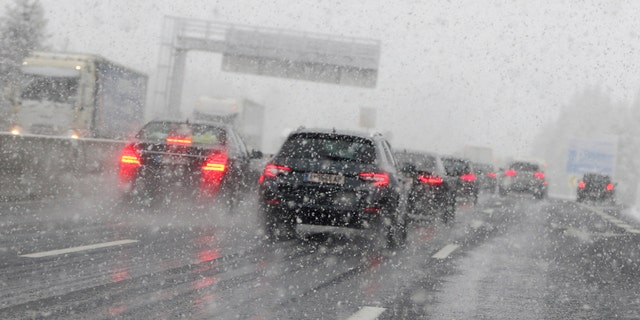
Tasmania’s wintry blast continued overnight, with Launceston in the state’s north receiving its most significant snowfall since the early 1970s and the weather bureau says it is not over yet.

Launceston was hammered by snow as the temperature at the airport plummeted below zero just after 9pm on Tuesday while Scottsdale, to the northwest, reached 0.9 degrees about half an hour later.

It was all caused by an air mass moving north from Antarctica. Let’s call this phenomenon an Antarctic blast. Arctic blasts occur on the northern hemisphere!


Bureau of Meteorology Matthew Thomas told Yahoo News Australia the snow forming in Tasmania’s north is a weather event not seen in the area for about 40 years.

“The last time we saw snow settle in Launceston was in the early 1970s,” Mr Thomas said.

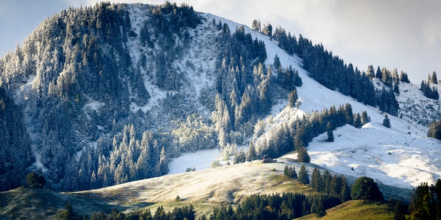
“It’s a very rare event for Tasmania. We also saw some snow settled in Hobart with the last two occurrences in 1986 and 2015. However, it’s not uncommon to see snow in the south of Tasmania.”

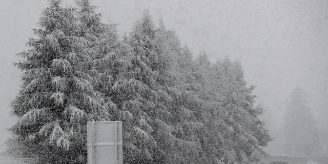
Settled snow is when it forms on the ground. Snowfall, while it is fairly uncommon, does occur in Australia but it’s rare to have it pile it up where you can physically step in it.

Mr Thomas added BOM doesn’t record snowfall either as it’s mostly recorded as rain. This is because it melts fairly quickly.

Weatherzone meteorologist Ben Domensino described it as “a historic event for Tasmania.”

Grindelwald – a Swiss-themed village just north of Launceston – was looking a little more Swiss than usual this morning. At 190m above sea level in northern Tasmania, this is a rare sight,” he tweeted.

On social media, people marvelled at the conditions. Some people filmed and pictured themselves skiing and snowboarding through Launceston’s CBD.

I’m 61 years old. Never seen it snow in Launceston,” one man tweeted.

People described it as a “winter wonderland” while the Prospect Hawks Football Club were filmed training on a sodden, snow-covered field on Tuesday night.


nivek

As Above So Below
Forget Warming, Here Comes Cooling: Scientists Announce Little Ice Age In Coming Decades

Scientists studying the intensity of solar activity have declared that the earth is heading towards a very cold climate phase, akin to the Little Ice Age of the 17th century, or worse.

In a newly published paper in Astrophysics and Space Science, scientists have analyzed historic solar activity and have predicted that the next two solar cycles—25 and 26—will be weaker than all of the previous 24.

But aren’t we supposed to be headed towards a warming apocalypse?

Welcome to climate reality!

I’ve not met a single climate scientist who denies global warming. The warming trend of the last 150 years or so is universally accepted and documented. However, climate scientists disagree on details, like when the warming began and what caused it.

Contrary to public perception, global warming did not begin with the industrialization of our society, a period during which there was an exponential increase in carbon dioxide (CO2) emissions from anthropogenic sources.

The current warming trend began in the 19th century when the Little Ice Age—which had prevailed for at least two centuries—came to an end. No significant anthropogenic CO2 emissions brought the Little Ice Age to its end. The warming appears to have been purely natural.

And the most likely cause is the sun.

SOLAR CYCLES AND SUNSPOT ACTIVITY

Earth’s temperature levels are regulated primarily by changes in the sun’s activity. The intensity of solar activity influences changes in our climatic system.

Changes in solar activity are usually measured by the number of sunspots. Scientists observe periodic variations in the average number of sunspots and categorize them as “solar cycles.”

Each solar cycle lasts roughly 10 to 11 years and usually correlates closely with temperature on earth.

Weak cycles, with fewer sunspots, usually result in cold climatic conditions on earth.

Such was the case with the Little Ice Age, when solar cycles were weaker than any since then. Climatologists refer to the extremely low periods as the “Maunder Minimum” (~1645–1715) and the “Dalton Minimum” (~1790–1830).

Likewise, strong solar cycles result in warmer temperatures. The relatively rapid warming post-Little Ice Age can be attributed to increased solar activity.

Solar activity in the past 60 years has been higher than average for the 1150-year period for which we have data. This is the primary reason for the rise in temperatures in the 1970s through 1990s.

Satellite temperature measurements show no significant warming since then. For the past 19 years, temperatures levels have remained largely stable. Unsurprisingly, this lack of warming coincides with a decline in solar activity.

Alarm bells went off in recent years when scientists began predicting that we might be headed for a solar minimum. The recent paper on solar cycles 24 and 25 validates their concern and warns that the upcoming solar minimum could be more severe than the brutal Maunder Minimum.

The effects of efforts to reduce CO2 emissions, regardless of whether we succeed, will be miniscule compared with the impact of a solar minimum.

Any true climate enthusiast will respect the well-established and well-understood role of solar activity as the most significant drivers of climate on earth and warn people about the imminent cooling.

But political leaders’ obsession with global warming could leave us susceptible to the greater dangers of cooling.

.
 

nivek

As Above So Below
More signs of coldness coming?...

...

Norway records coldest summer in nearly 60 years

norway-snow-july-2020-2.jpg


Residents in Norway have been reeling from the country's coldest summer in nearly 30 to 60 years. By early July, more than 10 m (32 feet) of snow accumulated in parts of the southern region, which was unprecedented for this time of the year.

According to state meteorologists, Oslo has recorded an average temperature of just 14.7 °C (58.5 °F) this month, which was the coldest in nearly 30 years.

Meanwhile, Bergen's average has been even colder at 12.8 °C (55 °F). Trondheim hit 12.1 °C (53.8 °F), the coldest for almost 60 years.

"In Oslo, we have to go back to 1993 to find such low average temperatures as we’ve had this summer, and back to 1996 in Bergen. In Trondheim, we have to go all the way back to 1962," state meteorologist Gunnar Livik confirmed.

Snow has also been covering the mountains, with Folldall hitting a below-freezing temperature of -4 °C (24.8 °F).

norway-snow-july-2020.jpg


It was warm in June when the summer season started, but going into July, it has been unusually cold in Norway.

The country entered the month with unprecedented accumulated snow of more than 10 m (32 feet) in parts of the southern region.

"We have not had such [heavy] snowfall as this year," said Knut Kinne, watercourse technical manager at BKK who conducted clearing operations in the mountains.

"We had a clear change in the weather at the end of June," Livik continued. "July has been a cold month with lots of unstable weather."


.
 

nivek

As Above So Below
Climate change is normal as is Global warming.

Absolutely, this short term warming trend we called global warming will be followed by another cooling trend, likely a mini ice age because the earth is in a long term cooling trend overall...The climate is always changing and with the magnetic pole shifting in motion we are likely to see more extremes before it's over...

...
 

nivek

As Above So Below
Meanwhile in Australia...


nivek

As Above So Below
Farmers almanac is calling for a very cold and snowy winter for my region of the country, I also think it's going to get colder much sooner this year by the signs of the wildlife activities and plant life changes...Time will tell...

...
 

nivek

As Above So Below
Denver Officially Experiences Earliest Freeze on Record: Sept. 8

DENVER (CBS4) – Just before 8:30 a.m. Tuesday, the official weather station for Denver recorded 32 degrees. It’s a tie with September 8, 1962, for the earliest freeze on record going back nearly 150 years.

Even colder weather is expected Tuesday night with the first hard freeze of the season. Many locations along the Front Range will drop into the upper 20s by early Wednesday morning and teens will be found in the mountains. It will feel like the second week in December instead of the second week in September.

51.png

(source: CBS)

The freezing weather has prompted a Freeze Warning for parts of the state that have not yet experienced freezing weather this season including the entire metro area and most of the Eastern Plains.

52.png

(source: CBS)

Daily record low temperatures are also expected in Denver on Tuesday if the temperature drops below 31 degrees before midnight (which seems likely). The current record low is 31 degrees set on September 8, 1962. Another record is expected to be easily broken Wednesday because the record low for September 9 in Denver is only 35 degrees from 1898.

5day.jpg


.
 

nivek

As Above So Below
It seems an early winter is coming...


nivek

As Above So Below
 

nivek

As Above So Below
Alps surprised by early snowfall, Swiss town sees new record

BERLIN – Parts of Switzerland, Austria, and Germany were surprised by unseasonably early snowfall overnight, after a sharp drop in temperatures and heavy precipitation.

The Swiss meteorological agency said Saturday that the town of Montana, in the southern canton (state) of Valais, saw almost 10 inches of snowfall — a new record for this time of year.

AlpsSnow_1.jpg

A car makes his way through heavy snow on motorway A 13 in Noesslach near Innsbruck, Austria, Friday, Sept. 25, 2020. (AP Photo/Matthias Schrader)

Authorities were out in force across mountainous regions to clear roads blocked by snow and ice.

AlpsSnow_2.jpg

Cars make their way through heavy snow on motorway A 13 in Noesslach near Innsbruck, Austria, Friday, Sept. 25, 2020. (AP Photo/Matthias Schrader)

In parts of Austria, snowfall was recorded as low as 1,805 feet above sea level.

AlpsSnow_3.jpg

Fresh snow is visible on the slopes of the Moleson mountain near the still green pastures, on Saturday, 26 September 2020, at Moleson in Gruyere, Switzerland. (Laurent Gillieron/Keystone via AP)


.
 

nivek

As Above So Below
Early snowstorm shatters 115-year-old record in Twin Cities

An early-season snowstorm blasted several northern states with significant snowfall on Tuesday, with accumulations in Minnesota's Twin Cities shattering a record that had stood since Theodore Roosevelt's second term as president.

Conditions began deteriorating across Minnesota on Tuesday early in the afternoon as a winterlike storm caught the state in its crosshairs.

The National Weather Service issued a winter storm warning for parts of central Minnesota and west-central Wisconsin for the first time since mid-April, giving residents a taste of what is around the corner. AccuWeather forecasters had been calling for the storm to dump between 6 and 12 inches across the Minneapolis area.

As early in the season as it seems for snowfall, it wasn't the first time that flakes have flown in the autumn air. The Twin Cities had already observed the first snowfall of the year with 0.2 of an inch on Oct. 16 and a trace amount of snowfall on Monday, Oct. 19. The cities had yet to reach the first inch of snowfall for the season, but that changed in dramatic fashion on Tuesday afternoon.

By Tuesday evening, the Minneapolis-St. Paul International Airport reported 7.9 inches of snow, the earliest in the season that the Twin Cities have measured this much snow. The airport fell just shy of its all-time snowiest October day, which stands at 8.2 inches from Oct. 31, 1991.

Previously, the earliest that 4 inches or more of snow had fallen in Minneapolis was on Oct. 29, which occurred more than a century ago in 1905. On that date, 5.5 inches were recorded.

Screen-Shot-2020-10-21-at-3.01.20-AM.png
 

nivek

As Above So Below
Climate scientists throw cold water on 'Arctic methane bomb' report

A research team made a worrisome discovery off the Siberian coast, The Guardian reports. The scientists say they believe they are first to uncover observational evidence that frozen methane deposits in the Arctic Ocean have started to be released after determining that methane levels at the ocean's surface were four to eight times higher than expected.

The deposits are considered "sleeping giants of the carbon cycle" and could theoretically expedite climate change, given that methane has a warming effect 80 times stronger than carbon dioxide over a 20 year period, The Guardian notes. But while the discovery sounds alarming, it's also been met with skepticism from some climate scientists.


Gavin Schmidt, a climatologist and director of the NASA Goddard Institute for Space Studies, argued there is no evidence Arctic methane had a "big effect" even in earlier periods when the region was warmer than it is now.

The scientists who made the discovery, meanwhile, have acknowledged their work is preliminary, and said the scale of methane releases will not be confirmed until they return and analyze the data. Either way, "there is unlikely to be any major" climate effect "at this moment," Swedish scientist Örjan Gustafsson, told The Guardian from the research vessel. But he did maintain his stance that "the process has now been triggered." Read more at The Guardian.

.
 

nivek

As Above So Below
Historic blizzard in Canada shuts down everything

We are clearly in a mini ice-age! And the latest example of this always colder temperature blast happened last Tuesday in Labrador, Canada.

While a major cyclone was threatening Somalia, a record-setting blizzard shut down parts of Labrador, forcing the closures of roads, provincial government offices and flights. Moreover, schools closed their doors in Happy Valley-Goose Bay, North West River and the regional College of the North Atlantic campus.


At one point during the storm, snow was falling at an unbelievable rate of 5-10 cm an hour. As you understand, what experienced Labrador on Tuesday was a real extreme weather event that had already buried Ontario and Quebec in heavy snow last weekend… And drenched Newfounland with heavy rains through Tuesday.

blizzard-labrador-canada-november-2020.jpg

Happy Valley-Goose Bay received 75 cm of snow in 2 days. The previous two-day November record was 70.6 cm.

The heavy snow storm also broke Happy Valley-Goose Bay one-day monthly record with 46.6 cm received on Tuesday (previous record was of 40.6 cm).

It is the 5th time in the town’s history, that a 70+ cm snowfall event has been recorded.


(More on the link)

.


Xuu

Honorable
It's why they use the word Climate Change instead now. Global warming is, globally, accurate... Butsome local regions will cool due to the changes.

The UK is on nearly the same latitude as Alaska, but we're not an icy hellscape like there is. If gkoavl warming upsets the gulf stream like some models predict, that'll change.
 

nivek

As Above So Below
Thats what I think is a likely possibility, global warming creating too much ice melt in a short time upsetting the gulf stream and slowing it to a crawl thereby causing a mini ice age to occur...Maybe 30-50 years from now, possibly, maybe...

Then there's another matter of the poles shifting, we just don't really know what effects if any its going to have on our climate, even if temporarily, when it happens...I know a lot of predictions shown it to be a very slow transition but again we really don't know, there's no firsthand recorded transmission of what took place for us to prepare...Could the poles completely flip in a few decades or will it take a few hundred years?...

...
 

nivek

As Above So Below
 

nivek

As Above So Below
These unprecedented snow storms are signs the next little ice age has just started!

Signs are all around us. Temperatures on planet Earth are currently diving big time, resulting in unprecedented snow storms around the world.

The temperature of the Global Lower Atmosphere has plunged by almost half a degree Celsius from February 2020 high of 0.76°C to just 0.27°C above baseline in December 2020.

The time to prepare is now!


temperature-lower-atmosphere-decreases.jpg
Temperature of the global lower atmosphere has decreased dramatically within December 2020.

Here some more examples were are plunging in the next mini ice age:

18 inches of snow in Texas desert

On New Year’s Day, Big Bend National Park — usually concerned with heat stroke or bears — warned visitors:

Roads in Big Bend National Park are currently impassable,” officials wrote on Facebook. We received between 12-18 inches of snow last night and it’s still snowing. Please do not attempt to enter the park.


Snowfall total maps confirm 12 to 18 inches of snow were dumped on the West Texas park. – San Antonio Express News

Italy Alps buried in 6 feet of snow

About two meters (over 6 feet) of snow fell early Monday in parts of northern Italy’s alpine region, blocking roads and burying cars and houses in some areas.


Forecasters say more snow is expected in the area region in the coming days.VOA News

Soon we going to dig horses out of the snow like during this Icelandic storm in 2019:

Screenshot_20210106-182814.jpg

1 meter of snow in 24 hours in Austria


Heavy snowfall in Asturias, Spain

Several people were trapped and two were killed after severe snowfall in Leon, in the Spanish region of Asturias.

An avalanche killed two workers that came in to deblock a road.


Four other adults and one child were rescued from two vehicles buried under the snow.

Meanwhile, much of Spain is experiencing sub-zero temperatures this week and some of the “heaviest snowfall in recent years”, with even Madrid and Barcelona expected to be turned into winter wonderlands.

Yes, much of the country is set to experience some unusually cold weather even for this time of year with ‘Storm Filomena’, bringing frigid temperatures dropping to -10°C in northern and central Spain and heavy snow fall at abnormally low altitudes (down to 200 meters).

Temperatures on planet Earth have plummeted in line with the great conjunction, the ongoing magnetic reversal/excursion, and the ever-intensifying Grand Solar Minimum. Yes, it really looks like we are currently entering a new Little Ice Age.

Screenshot_20210106-183028.jpg

.
 

nivek

As Above So Below
Top