Why can't we find missing planes like flight MH-370??
There are only around 10 US, Russian and European satellites capable of such detailed images. They each orbit Earth roughly every hour and a half, imaging a strip a few hundred kilometres wide as they go. “Each one probably covers a few per cent of the Earth every day.
They could have taken an image of the downed plane. We don’t know the exact capabilities of these satellites, but they are likely to take sharper pictures than the civilian equivalent, They are also probably equipped with more advanced colour filters and the NRO is likely to have advanced image analysis software, both of which could help pick out wreckage from the sea.
Planes are usually tracked by;
- ADS-B is less common with only 35% of planes equipped in the US.
- MLAT, 99% of Europe is covered, only parts of the US are. At least four receivers are needed to calculate the position of an aircraft
- TAR (primary) radar relies on radio waves reflecting off metallic objects and is effective within a short range from the radar head 160 nmiles away
- En route radar, or secondary surveillance radar, relies on an aircraft having a transponder which transmits a data signal. The signal is received and interrogated by a ground station ranging from 250 nmiles (463 km) in radius and up to 100 000 ft (30 km). Not very much at all.
The ease with which Malaysia Airlines flight MH370 disappeared from radar systems illustrates how modern aviation relies on ageing ground infrastructure. The inability of 26 nations to find a 250-tonne Boeing 777 has shocked an increasingly connected world and exposed flaws in the use of radar, which fades over oceans and deserts.
We track our cars, we track our kids' cell phones, but we can't track airplanes when they are over oceans or other remote areas. Satellites provide the obvious answer, experts say. However the overhaul of current systems would be costly
All planes have a radar transponder that squawks their identity and location via terrestrial radio signals. But once they pass out of range of land-based radar, a few hundred kilometres from the shore, aircraft are often on their own until they’re picked up by the next receiver.
Planes are big, but the ocean is much bigger and searching can be difficult. It took two years to find the wreckage of an Air France airliner that went down in the mid-Atlantic in 2009. And it’s not just planes that disappear into the abyss. On 4 February 2013, a 1400-tonne ocean liner, the Lyubov Orlova, went missing and has never been found.
What about Spy satellites?
The US National Reconnaissance Office (NRO) has an extensive network of spy satellites that cover the globe and could have taken an image of the downed plane. We don’t know the exact capabilities of these satellites, but they are likely to take sharper pictures than the civilian equivalent, They are also probably equipped with more advanced colour filters and the NRO is likely to have advanced image analysis software, both of which could help pick out wreckage from the sea.
So could the NRO have a picture of the plane?
It is not the NRO’s job to track commercial airliners. The satellites’ orbits are public knowledge and some have passed close to the plane’s last known location, but they may not have been imaging at the time. If the agency does have a picture, it would probably quietly pass that information to the relevant authorities, says McDowell.
Many satellites don’t take pictures in visible light, but use other wavelengths instead. The NRO’s infrared satellites look for the heat signatures of missile launches around the world, and could potentially see a plane exploded in mid air. According to The New York Times, the US Department of Defense has checked the surveillance data and found no evidence of an explosion.
"Using a system that looks for flashes around the world, the Pentagon reviewed preliminary surveillance data from the area where the plane disappeared and saw no evidence of an explosion,"
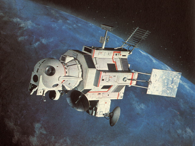
I had a look through pretty much all the current ICBM programmes allied forces have, all of which rely on ground based radar (PAC-3, Aegis, THAAD etc) to detect missiles. But for Intercontinental ballistic missiles, such as the one tested by North Korea, fly far too high and fast for these systems to engage with. This is where GBMD comes onto the scene. It mostly relies on various radar.., but I'll ignore them to discuss the 3 satellite programmes being used..
Ground Based Midcourse Defense. (GBMD)
The Ground-Based Midcourse Defense (GMD) program uses land-based missiles to intercept incoming ballistic missiles in the middle of their flight, outside the atmosphere. The well-known Patriot missiles provide what’s known as terminal-phase defense options, while longer-reach options like the land-based THAAD intercept missiles coming down. Even so, their sensors and flight ranges are best suited to defense against shorter range missiles launched from in-theater. GBMC uses ground-based radar, backed by 3 different satellite programmes.
1) The Defense Support Program (DSP)
First launched in 1970 is a constellation of satellites in geosynchronous orbit (GEO) that used infrared sensor to detect heat from missile and booster plumes against the Earth's background.. The satellites include a spinning sensor with short- and mid-wave infrared radars that have a 10-second revisit rate, though they are not dynamically taskable. Each unit is estimated to cost around $400 million. Due to be superceded by the Space-based Infrared System. (See 3 below)
2) Space Tracking and Surveillance System (STSS)
A space-based system developed and operated by the Missile Defense Agency that detects and tracks ballistic missiles. This system is an experimental component of the U.S. Ballistic Missile Defense System (BMDS) and STSS serves as a complement to other U.S. space-based platforms.
The aim of the Space Tracking and Surveillance System is to track missiles through all three phases of flight (boost, midcourse, and terminal); discriminate between warheads and decoys; transmit data to other systems that will be used to cue radars and provide intercept handovers; and provide data for missile defense interceptors to hit their target.
The STSS constellation orbits at 1,350km with a 58-degree incline and has a two-hour orbital period. The sensors on the two satellites detect visible and infrared light. and has three main components: a wide-view acquisition sensor, a narrow-view tracking sensor, and a signal and data processor subsystem.
The wide-view acquisition sensor will detect missiles during their boost phase. (No ground view)
Once it reaches its midcourse phase, STSS follows its trajectory through space with a narrow-view tracker. While both the wide- and narrow-view sensors hone in on a missile, they send information to the system’s signal and data processor subsystem which is capable of sifting through some 2.1 gigabits of data per second. This subsystem can detect and track over 100 objects at a time and will be able to determine what objects in space are missiles or warheads
The goal of an operational STSS is to track missiles through all three phases; discriminate between warheads and decoys; transmit data to other systems
3) Space-based Infrared System (SBIRS)
This system is intended to replace the aging DSP system of satellites. SBIRS satellites are able to scan large swaths of territory to detect missile activity and can also hone in on areas of interest for lower-scale activities, including launches of tactical ballistic missiles. These sensors are independently tasked, meaning the satellite can both scan a wide territory and fixate on a particular area of concern simultaneously.
The first satellite, SBIRS GEO-1, launched in May 2011 and was followed in March 2013 by the SBIRS GEO-2 satellite. July 2015, third satellite and fourth satellite first, on October 2016.
In addition to the dedicated satellites, the system also includes two missile warning sensors hosted on classified satellites in HEO that were launched in November 2006 (includes a scanning sensor composed of short- and mid-wave infrared radars that can see close to the ground) and a fourth satellite in June 2008.
The constellation has a continuous view of all of the earth’s surface, which it images every 10 seconds while searching for infrared (IR) activity indicating heat signatures.5 SBIRS is able to detect missile launches faster than any other system and can identify the missile’s type, burnout velocity, trajectory, and point of impact
The system was initially designed to include satellites in low earth orbit. However, this program was incorporated into the STSS program in 2001 and handed over to the Missile Defense Agency (MDA) and is intended to replace the Defense Support Program (1 see above)
SBIRS GEO was deployed in 2011 and consists of both taskable and nontaskable sensors with both scanning and staring payloads with short- and mid-wave infrared radars. It is able to both have a hemispheric ground of view as well as see very close to the ground.
SBIRS HEO, launched in 2006, was the first deployed asset.
It is re-taskable and includes a scanning sensor composed of short- and mid-wave infrared radars that can see close to the ground.
As of 2015, the system’s current total program cost was almost $19B for six satellites.
As of 2015, two of the four planned satellites are in orbit as well as three complementary scanning sensors on intelligence satellites in HEO
SBIRS is positioned so that it would be the first U.S. asset to detect a ballistic missile launch. Once it detects significant activity, that information is transmitted to Air Force Space Command in Colorado and subsequently to North American Aerospace Defense Command (NORAD) and other relevant parts of the military who will decide whether the launch threatens the United States or its interests.
The science is in the growing set of algorithms used to manipulate data collected by the system. Work in the “battlespace awareness” mission for satellite IR data can take hours today.
The only image released for public use from the Sbirs system is this one.
It captures the heat plume emitted by a Delta IV predawn launch. The plume is readily visible against the backdrop of Earth, which in the early morning hours sees little heat and sunlight.
SBIRS OPS CENTER
The ops center is a modern, wide space dotted with computer consoles. Personnel in an intelligence cell are of to the side. A space in the center will be occupied by each shift’s director
The gravity of the mission contrasts with the youth of its operators at Buckley, most of whom were born after the ending of the Cold War that drove development of the missile warning and defense architecture. The average Sbirs operator is about 20 years old and has about six months’ experience working the console. The ops fl oor is populated by a multinational presence, including British, Australian and Canadian military of cials. These operators work 12- hr. shifts, constantly monitoring computer screens. The Sbirs operators are divided into four areas aligned with its four missions: missile defense, missile warning, technical intelligence and battlespace awareness
NON - MILITARY
Factoring in things like maintenance, cloud cover and the fact that they don’t take images all the time, that probably means at most 5 per cent of the planet is imaged in high-resolution each day. Some areas, such as cities, are imaged much more than others, this can be seen in Goggle maps where areas can be low res and years old.. "Open ocean is not what you’re taking pictures of" Jonathan McDowell of the Harvard-Smithsonian Center For Astrophysics in Cambridge, Massachusetts.
Ball Aerospace is the maker of Maps- and Earth-related imagery satellites and it’s now started working on the Worldview-3 satellite for commercial satellite operator DigitalGlobe. Ball project manager Jeff Dierks, who has worked on most satellites opperated by companies that sell images to Google, says the technology used by these gigantic flying cameras is rather basic. “At its simplest, it is a decent resolution digital camera in space,” he said and explained that instead of taking individual pictures it takes continuous images “along thin strips of land or sea.”
Commercial images such as the ones Google Maps and Google Earth use, meanwhile, will only show objects that measure 50cm (20 inches).
Weather satellites take pictures of the entire planet each day, but only once per hour at very low resolution.
All of these satellites are used for very specific purposes. Missile watch is taken very seriously and the technology is not used as a toy or for other purposes.
If you have ever looked through binoculars or a telescope and waved your hand in front of the lens, and passes by like an almost invisible blur.., the same applies for all telescopes and lenses. This means if the camera has a wide field of view (the image of Australia).., then each pixel is too small to see a car, plane, boat of a potential UFO. The more zoomed in.., the shorter the FOV etc.., but we'll get into that boring stuff later.