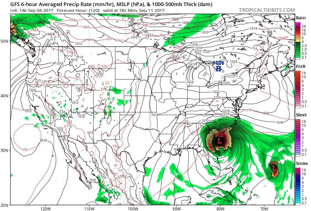
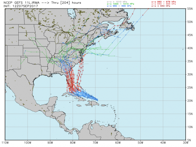
00z models have responded. GFS, CMC, AND THE NAM now have Irma staying off the Florida coast and turning due north. This trajectory takes it towards the SC/NC border where they indicate landfall. Main reason behind this: the "Fujiwara effect" as hurricane Jose acts as the main steering mechanism for Irma and steers it more to the north. Also, 00z data is showing an inland landfall that tracks Irma into central NC and central VA.
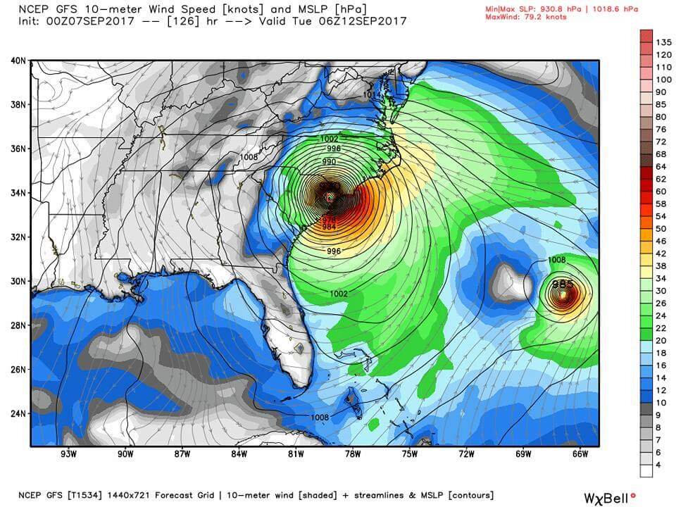
If you live in FL, SC, NC, VA you need to start preparing for significant impacts including long-duration wind event. Models slow Irma once it landfalls, and is slow to weaken Irma thanks to Jose attaching feeder bands to Irma and pumping moisture into Irma even after it landfalls. In addition to long duration wind event, hurricane force winds in excess of 120mph+ will be possible across central NC and central VA. Torrential flooding rains and coastal flooding, along with tornadoes across the coastal plains. Biggest threat from FL to VA also including GA is the storm surge, but will maximize and be significant northeast of landfall, which if this track verifies, Wilmington up through Hatteras and OBX would experience significant storm surge.
I can not stress this enough and can not be emphasized enough Irma possesses the chance to be a very strong Category 5 hurricane on landfall. Take this threat more serious than you ever have, do not compare this event to past hurricanes. Irma will likely surpass all recorded hurricane events. Irma poses a very serious threat to life, and will posses catastrophic conditions even after landfall. Even if it weakens to a Cat 3, it will still carry Cat 5 hazards/risk such as storm surge. Please monitor Irma closely over the next 48hrs and do not wait to evacuate if you find yourself in Irma's path over the next 48hrs and you live in coastal areas, get out and evacuate!!!